Post by snowlover91 on May 29, 2017 11:02:32 GMT -5
HRRR finally shows a nice cluster of strong to severe storms moving through late this evening, after 9pm, as a shortwave moves through. Fwiw, the HRRR has shown nothing of substance for our area the past 2 days and it's been right. Now that it's showing a nice cluster of storms late tonight... I think we might finally see a few severe storms.
Post by downeastnc on May 29, 2017 13:47:58 GMT -5
If its that late the chances of severe are lower IMO, will need it to be a organized line/segment/ MCS to get anything good. Timing is key and the models originally had the front in here midday which with this atmosphere would have been nasty. Pwats are kinda low too, plus the cap nowhere close to breaking equal bah.....
Last Edit: May 29, 2017 13:49:50 GMT -5 by downeastnc
If its that late the chances of severe are lower IMO, will need it to be a organized line/segment/ MCS to get anything good. Timing is key and the models originally had the front in here midday which with this atmosphere would have been nasty. Pwats are kinda low too, plus the cap nowhere close to breaking equal bah.....
According to SPC Mesoanalysis, PWAT is 1.5" over my house right now -- respectable. And effective bulk shear is pretty strong, too. But instabilities are surprisingly weak -- only 1,000j/kg SBCAPE, which is disappointing. LI is a paltry -3. Oh well. I didn't want a big supercell in the middle of the night anyway. Although an inch of rain would be nice.
Finally hear thunder and all its good for is waking me. Talk about a miserable way to bust a 3 day slight risk. What a joke.
It was a different story for the 14 people injured in sampson county last night. Either some serious straight line winds or a possible tornado. NWS survey team checking it out today. See link below.
Post by downeastnc on May 30, 2017 10:54:37 GMT -5
The last 3 days where a joke severe wise the Sampson storm is small localized downburst during a 30 min period where the storm got severe....overall there are almost no severe weather reports anywhere in NC after 3 days of large portions of the state being in slight risk. It was even well modeled to not be much of anything on the hi res models its curious that the SPC was so bullish when there was little support to do so.
The last 3 days where a joke severe wise the Sampson storm is small localized downburst during a 30 min period where the storm got severe....overall there are almost no severe weather reports anywhere in NC after 3 days of large portions of the state being in slight risk. It was even well modeled to not be much of anything on the hi res models its curious that the SPC was so bullish when there was little support to do so.
Well last night was quite active across Southern NC with around 20-25 reports of wind damage. It wasn't just Sampson county, that storm and others went all the way to Carteret where an 82mph gust was recorded. Sure, our area in Greenville and Wilson to RDU was quiet but the areas just to our south were in a slight risk also and it was definitely justified for them yesterday. The other two days were duds but yesterday wasn't. Should find out today if this was a tornado or just strong straight line winds. Here are more pics. www.wral.com/weather/image_gallery/16731599/
Really it was just that one storm that was responsible for those reports, granted it was bad where it was bad but overall a marginal threat area would have been more than enough given the coverage of actual severe weather.
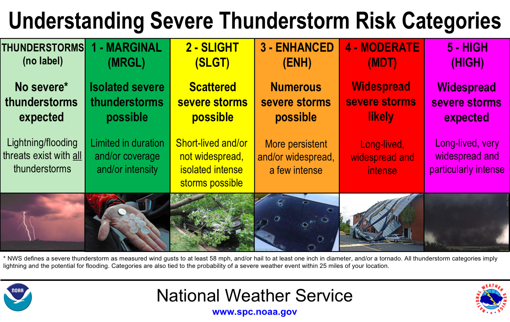
Nah it wasn't just that one. There was a severe storm around Charlotte that produced wind damage and then a few further south that moved into Carteret county and produced wind damage and gusts of 80+mph as well. Here is there infographic that shows what to expect and the chances for each level. As you can see this event produced several storms that produced wind damage and greater than 60mph winds, definitely fitting of the slight risk category.