4649 Postby jconsor » Sun Aug 02, 2020 6:54 am Good catch, NDG!
Because of that northward jog/reformation into the western edge of the burst of deep convection, Isaias's center at 12z is likely to end up about 30 mi east of the 12 hour NHC forecast from 0z. If this tendency to remain further east and stay just off the central/NE FL coast continues (and I believe it will, based on recent model trends), it strongly increases the risk of a period of intensification prior to NC/SC landfall.
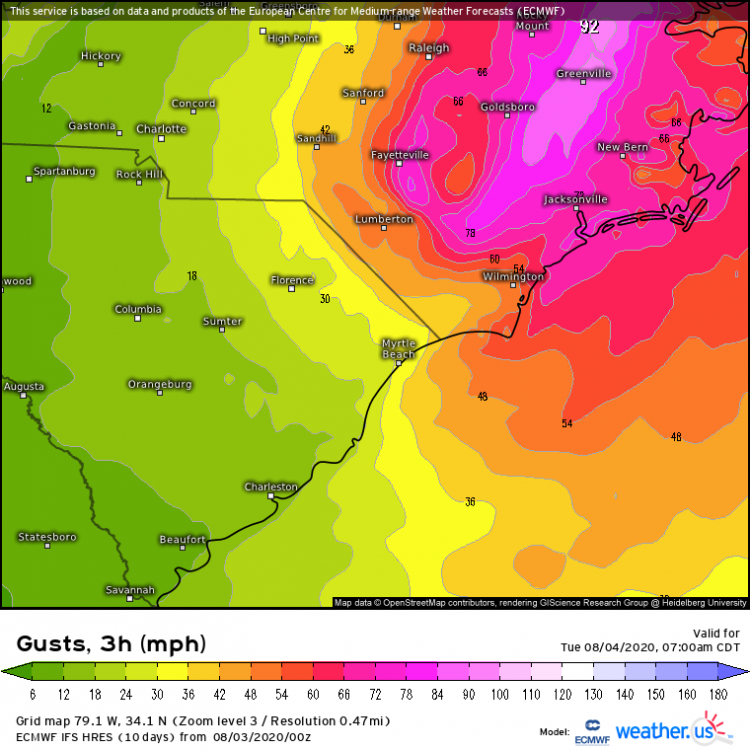
Given the trends I have seen, I believe a cat 1 landfall is more likely than not in NC/SC. Perhaps a lower-end Cat 2 if it is able to undergo RI, but I consider that a low-probability scenario at this point (about 10%). IMHO, a landfall intensity of higher end cat 1 or higher (e.g ~75 kt or higher) is most likely if Isaias stays at or east of about 80.3W - in other words, significantly enough off the NE FL coast to be better able to take advantage of the moistening atmosphere and very warm waters. Wouldn't be surprised to see isolated gusts to 100 mph in exposed coastal areas in the NE quadrant! (Most likely between Myrtle Beach, SC and Wilmington, NC
Joe Bastardi @bigjoebastardi · 1h Isaias may be pulling itself under convection Suspicious warm spot now appearing (lighter color) if so will ramp up,Notice it feature blew up in the early am hours. Diurnal effects in action. Opposite may happen this pm, but if not and offshore should become a hurricane again
Allan Huffman @raleighwx · 1h I am thinking landfall for #Isaias near the NC/SC border around 12am Tuesday as a 75-80 mph cat 1 hurricane which looks pretty close to the NHC forecast. I have no issues with the NHC track forecast.
I guess everyone did croak of corona. biggest wx event in years and everyone is either dead or hiding. moving more ne now. Might even landfall a bit east of me.
Pressure continues to fall like a rock at this NOAA buoy offshore the SC coast. Now reporting 989-990mb w/ 30 knot wind actual pressure is likely around 986-987mb & #Isaias almost certainly is a hurricane (again). Recon are currently en route to confirm #ncwx #scwx pic.twitter.com/WCReTsF6yb -- Eric Webb (@webberweather) August 3, 2020